Antigua and Barbuda Meteorological Services
12:30 PM Saturday 18 January 2020.
Forecaster: Dale Destin
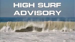
A high surf warning goes into effect Sunday for Antigua, Barbuda, Montserrat, St. Kitts, Nevis, Anguilla and the British Virgin Islands. The worst conditions are expected Sunday.
Moderate, long period swells, being generated by a powerful mid-latitude (bomb) cyclone, located over the northern North Atlantic, are heading towards the area. The swells are expected to cause very high surfs and very powerful rip currents, which will be a severe threat to life and property in the surf zone. There is also the increased likelihood of damage due to flooding of some low-lying coastal areas.
Seas: 2 to 4 metres (7 to 14 feet), occasionally or locally reaching 5 metres (17 feet). Swell period: 12 to 16 seconds. Swells: north at 2 to over 3.5 metres (6 to 12 feet) and occasionally higher.
Surfs (breaking swells): Over 3 metres (over 10 feet). These conditions will be very conducive for dangerous rip currents. Please note that surfs could be as much as twice the height of swells, depending on the bathymetry of the near shore areas.
Coastal flooding: High tides combine with onshore wind and swell actions will result in coastal flooding and
beach erosion.
Locations (to be) affected: Reefs and especially exposed northern and north-facing coastlines with relatively shallow, gently to moderately sloping near shore areas.
Timing: Sunday and Monday for Montserrat, St. Kitts and Nevis, and Sunday until Tuesday morning for the rest.
Impacts (possible/likely/expected): Loss of life – strong currents that can carry even the strongest swimmers out to sea; injuries to beach goers; beach erosion; sea water splashing onto low lying coastal roads; beach closures; disruptions to marine recreation and businesses; financial losses; damage to coral reefs; salt water intrusion and disruptions to potable water from desalination. High surfs can knock spectators off exposed rocks and jetties. Breaking waves may occasionally impact harbours making navigating the harbour channel dangerous.
Precautionary/preparedness actions: A high surf warning means that dangerous battering waves, with surfs of over 3 metres or over 10 feet, will pound the shoreline, producing life-threatening conditions. No one should enter the water, especially on the northern sides of the islands. All are also urged to say away from rocky and or coastal structures along beaches in the affected areas.
Rip currents are powerful channels of water flowing quickly away from shore, which occur most often at low spots or breaks in the sandbar and near structures such as groins, jetties and piers.
If caught in a rip current, relax and float. Don`t swim against the current. If able, swim in a direction following the shoreline. If unable to escape, face the shore and call or wave for help