SE: Tropical Storm Watches and Warning Issued
Meteorologist Danielle Banks takes a closer look at the Southeast where Tropical Storm Watches and Warnings have been issued.
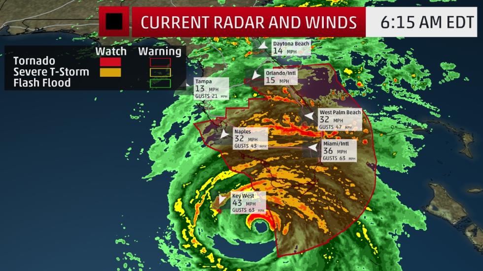
The eyewall of Category 4 Hurricane Irma is expected to slam ashore in the Lower Florida Keys between 7 and 8 a.m. EDT, according to the National Weather Service.
“Extreme, hurricane-force winds are imminent in the Lower #FLKeys,” tweeted the NWS office in Key West. “If you are here, please go to interior room away from windows!”
Winds have already gusted over 80 mph Sunday morning in parts of the Florida Keys. Water levels are already over 2.5 feet above normal tides at Key West and will only rise further with the approach of the eye.
Irma is the strongest hurricane strike on Key West since Hurricane Donna in 1960.Read More..https://weather.com/news/news/hurricane-irma-breaking-alert-10sep17-5am?cm_ven=FB_WX_AN_91017_3