Report from the Caribbean Disaster Emergency Management Agency (CDEMA) as at 9pm 22 September 2017
Saturday, September 23, 2017 — SYNOPSIS OF HURRICANE MARIA:
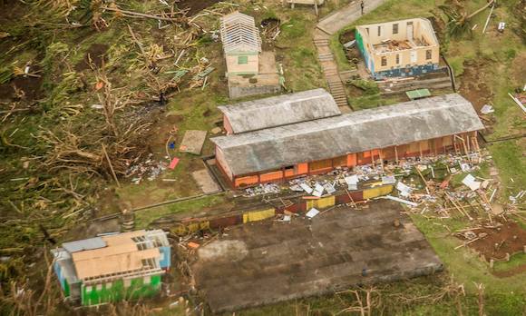
Maria, the 13th named hurricane of the 2017 Atlantic Hurricane Season, became a category 5 hurricane near the Leeward Islands on Monday September 18 th, 2017. Hurricane Maria impacted Dominica at approximately 9:35pm on September 18 th as an extremely strong hurricane with wind speeds of 155 mph. Maria then impacted St. Kitts and Nevis and Antigua and Barbuda on September 19th, 2017 and the Virgin Islands September 19 – 20, 2017. At 800 PM EDT (0000 UTC), September 22, 2017, the eye of Hurricane Maria was located near latitude 23.8 North, longitude 71.6 West. Maria is moving toward the north-northwest near 9 mph (15 km/h), and this general motion is expected to continue through Saturday. A turn toward the north is forecast by Saturday night. Data from an Air Force and a NOAA Hurricane Hunter aircraft and the NOAA P3 aircraft indicate that the maximum sustained winds remain near 125 mph (205 km/h) with higher gusts. Maria is a category 3 hurricane on the Saffir-Simpson Hurricane Wind Scale. Gradual weakening is forecast during the next 48 hours. Hurricane-force winds extend outward up to 60 miles (95 km) from the center, and tropical-storm-force winds extend outward up to 160 miles (260 km). The minimum central pressure based on data from both reconnaissance planes is 953 mb (28.14 inches).