National Hurricane Center.
Media Release
Updated for reconnaissance information For the North Atlantic, Caribbean Sea and the Gulf of Mexico.
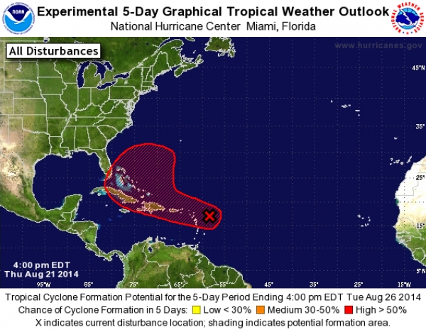
MIAMI, FL, U.S.A. (NHC | 04:00PM) — Data from an Air Force Reserve Hurricane Hunter aircraft indicate that the circulation associated with the small low pressure area approaching the Leeward Islands is poorly defined.
In addition, the associated shower activity has decreased during the past few hours. The aircraft did, however, find a small area of tropical-storm-force winds on the northeast side of the low.
Environmental conditions are expected to be conducive for some development during the next day or so, and a tropical depression or tropical storm could still form while the system moves west-northwestward at around 20 mph across the Lesser Antilles.
The mountainous terrain of Hispaniola could limit development during the first part of the weekend, but conditions are expected to become more conducive for development by Sunday when the system is forecast to move near or over the Bahamas.
Regardless of tropical cyclone formation, gusty winds and heavy rainfall are expected across portions of the Lesser Antilles, Puerto Rico, and the Virgin Islands through Friday, and over Hispaniola late Friday and Saturday. Interests in those islands and in the Bahamas should closely monitor the progress of this disturbance.
An Air Force Reserve Hurricane Hunter aircraft is scheduled to investigate this system again tomorrow afternoon.
Forecaster Brennan/Blake