BASSETERRE, ST. KITTS, July 4, 2026 – A tropical wave moving into the Caribbean is expected to bring increased shower and thunderstorm activity across the region before being followed by a surge of Saharan dust that could reduce air quality.
Meteorologists say tropical waves are the primary atmospheric drivers of weather across the Caribbean during the Atlantic hurricane season. These weather systems often produce clusters of heavy showers, thunderstorms, gusty winds and, under favourable conditions, can develop into tropical cyclones.
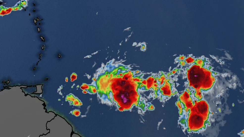
The latest active tropical wave, currently crossing the Eastern Caribbean, is generating scattered moderate convection, resulting in periods of heavy rainfall, isolated thunderstorms, and locally gusty conditions in some areas.
Meanwhile, the U.S. National Hurricane Centre (NHC) is closely monitoring another tropical wave moving across the central Atlantic Ocean that could bring additional heavy rain and gusty winds to parts of the Caribbean in the coming days.
The tropical wave is located approximately 900 miles east of the Windward Islands and is producing a broad area of showers and thunderstorms as it moves westward at about 20 mph.
Although the system is not yet a tropical cyclone, the NHC says there is a low chance of development as it tracks westward across the tropical Atlantic and into the Caribbean next week. The system has virtually no chance of developing during the next 48 hours, but its chances increase to 30 per cent over the next seven days.
Forecasters expect the current tropical wave to be followed by a significant plume of Saharan dust moving westward across the region. While the dry, dusty air is known to suppress the formation and intensification of tropical systems by introducing dry, stable air into the atmosphere, it can also reduce visibility and significantly degrade air quality.
Health officials typically advise people with asthma, allergies, and other respiratory conditions to limit prolonged outdoor exposure during periods of elevated dust concentrations. Residents are also encouraged to stay hydrated and monitor updates from local meteorological and health authorities.
Meteorologists continue to monitor tropical waves emerging from the west coast of Africa, as they remain a key feature of the Atlantic hurricane season and can serve as the seeds for future tropical storms and hurricanes. Residents throughout the Caribbean are encouraged to stay informed through official weather forecasts and remain prepared for rapidly changing weather conditions.
Based on its current track and forward speed, the first impacts are expected to be felt across the Windward Islands, including Barbados, Grenada, St. Vincent and the Grenadines, and Trinidad and Tobago, late this weekend into early next week. As the wave continues moving westward, periods of heavy showers, thunderstorms, and gusty winds could spread across the Leeward Islands, including St. Kitts and Nevis, Antigua and Barbuda, and Montserrat, before extending into Puerto Rico, Hispaniola, Jamaica, and portions of the western Caribbean during the middle of next week. Residents across the region are encouraged to monitor forecasts, as the exact timing and intensity of the system may change.